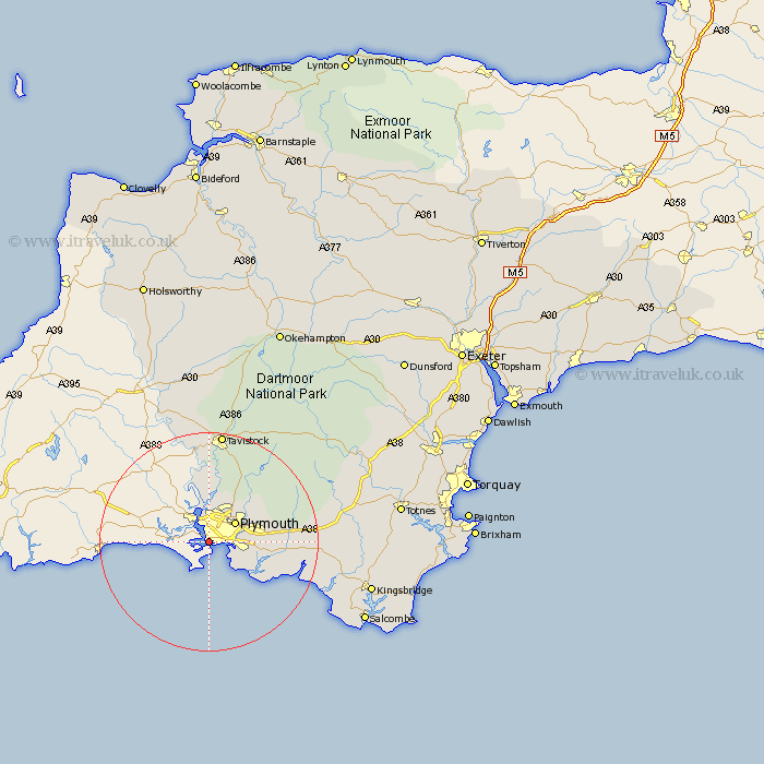
Devon Map Showing Location of Devonport
Easting: 244742 Northing: 54209
Latitude: 50.37 Longitude: -4.18
 = Devonport
Latitude: 50.37 Longitude: -4.18
= Devonport
This Devonport map below is supplied by Google. Use the tools in the top left corner to zoom into street level or zoom out for a road map, you may also need to zoom in to see Devonport on the map. Click and drag the map to move around. If the map fails to load try and refresh your browser or zoom in or out (+ or -).
Update - it seems Google no longer allow people to use their maps for free! This Devonport map sometimes loads and sometimes gives a error. I am working on a solution.
Closest 30 Towns or Cities to Devonport (Population over 500)
Plymouth 6.01km Wembury 9.01km Brixton 10.8km Newton Ferrers 12.01km Bickleigh 12.42km Shaugh Prior 13.23km Yealmpton 14.31km Yelverton 14.78km Buckland Monachorum 15.24km Horrabridge 15.96km Meavy 16.04km Cornwood 16.34km Holbeton 16.97km Walkhampton 18.62km Gunnislake 18.68km Whitechurch 18.86km Whitchurch 18.86km Ermington 18.91km Ivybridge 19km Tavistock 20.52km Modbury 21.36km Lamerton 22.24km Ugborough 23.71km Thurleston 25.08km Thurlestone 25.08km South Brent 25.89km Brent 25.89km Aveton Gifford 25.92km Milton Abbot 26.37km West Alvington 28.31km