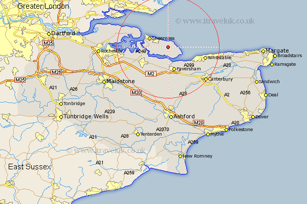
Kent Map Showing Location of Eastchurch
Population: 2718
District: Swale
Easting: 599380 Northing: 170728
Latitude: 51.4 Longitude: 0.87
 = Eastchurch
District: Swale
Easting: 599380 Northing: 170728
Latitude: 51.4 Longitude: 0.87
= Eastchurch
This Eastchurch map below is supplied by Google. Use the tools in the top left corner to zoom into street level or zoom out for a road map, you may also need to zoom in to see Eastchurch on the map. Click and drag the map to move around. If the map fails to load try and refresh your browser or zoom in or out (+ or -).
Update - it seems Google no longer allow people to use their maps for free! This Eastchurch map sometimes loads and sometimes gives a error. I am working on a solution.
Closest 30 Towns or Cities to Eastchurch (Population over 500)
Warden 2.31km Leysdown 3.47km Leysdown on Sea 3.47km Leysdown-on-Sea 3.47km Minster 3.93km Queenborough 7.18km Sheerness 7.86km Teynham 8.19km Oare 9.33km Faversham 9.55km Iwade 9.97km Sittingbourne 10.98km Ospringe 11.12km Bapchild 11.58km Grain 11.79km Lynsted 12.53km Linsted 12.53km Bobbing 12.83km Tunstall 13.94km Lower Halstow 14.36km Borden 14.82km Whitstable 14.84km Newington 14.95km Chestfield 14.95km Selling 15.22km Dunkirk 15.3km Upchurch 15.49km Bredgar 16.05km Doddington 16.37km Allhallows 16.75km