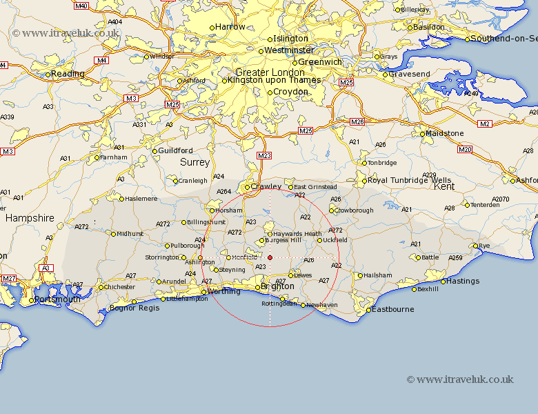
Sussex Map Showing Location of Ditchling
Population: 1802
District: Lewes
Easting: 533543 Northing: 114806
Latitude: 50.92 Longitude: -0.1
 = Ditchling
District: Lewes
Easting: 533543 Northing: 114806
Latitude: 50.92 Longitude: -0.1
= Ditchling
This Ditchling map below is supplied by Google. Use the tools in the top left corner to zoom into street level or zoom out for a road map, you may also need to zoom in to see Ditchling on the map. Click and drag the map to move around. If the map fails to load try and refresh your browser or zoom in or out (+ or -).
Update - it seems Google no longer allow people to use their maps for free! This Ditchling map sometimes loads and sometimes gives a error. I am working on a solution.
Closest 30 Towns or Cities to Ditchling (Population over 500)
Ditchelling 0km Ditchling 0km Hassocks 2.34km Keymer 2.34km Wivelsfield 3.88km Hurstpierpoint 4.67km Plumpton 5.11km Burgess Hill 6.03km Albourne 6.13km Baywards Heath 7.41km Haywards Heath 7.41km Lewes 8.07km Chailey 8.98km Kingston 9.44km Kingston near Lewes 9.44km Barcombe Mills Station 9.53km Lindfield 9.55km Newick 9.88km Brighton 9.92km Botney 10.19km Bolney 10.19km Hove 10.96km Cuckfield 11.36km South Nutfield 11.36km Henfield 11.68km Isfield 11.83km Fletching 11.92km Ringmer 12.26km Southwick 12.37km Portslade 12.37km