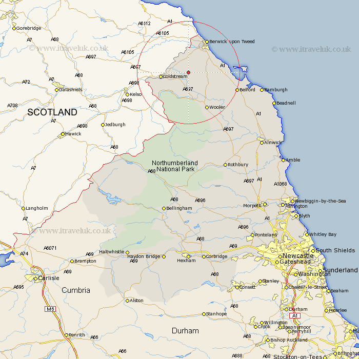
Northumberland Map Showing Location of Duddo
Population: 182
District: Berwick-upon-Tweed
Easting: 393710 Northing: 641469
Latitude: 55.67 Longitude: -2.1
 = Duddo
District: Berwick-upon-Tweed
Easting: 393710 Northing: 641469
Latitude: 55.67 Longitude: -2.1
= Duddo
This Duddo map below is supplied by Google. Use the tools in the top left corner to zoom into street level or zoom out for a road map, you may also need to zoom in to see Duddo on the map. Click and drag the map to move around. If the map fails to load try and refresh your browser or zoom in or out (+ or -).
Update - it seems Google no longer allow people to use their maps for free! This Duddo map sometimes loads and sometimes gives a error. I am working on a solution.
Closest 30 Towns or Cities to Duddo (Population over 500)
Norham 6.38km Ancroft 7.28km Lowick 9.15km Ord 10.63km East Ord 10.63km Berwick-on-Tweed 14.4km Berwick-upon-Tweed 14.4km Berwick 14.4km Berwick on Tweed 14.4km Berwick-Upon-Tweed 14.4km Berwick upon Tweed 14.4km Wooler 16.11km Belford 18.31km North Sunderland 29.39km Beadnell 32.05km Embleton 36.59km Almwick 38.9km Alnwick 38.9km Rothbury 40.91km Shilbottle 42.44km Alnmouth 43.24km Lisburg 43.8km Lesbury 43.8km Warkworth 46.54km Swarland 46.87km Longframlington 47.07km Amble 49.33km Felton 49.53km Thirston 50.07km East Thirston 50.07km