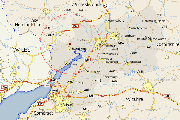
Gloucestershire Map Showing Location of Drybrook
Population: 2855
District: Forest of Dean
Easting: 365563 Northing: 216990
Latitude: 51.85 Longitude: -2.5
 = Drybrook
District: Forest of Dean
Easting: 365563 Northing: 216990
Latitude: 51.85 Longitude: -2.5
= Drybrook
This Drybrook map below is supplied by Google. Use the tools in the top left corner to zoom into street level or zoom out for a road map, you may also need to zoom in to see Drybrook on the map. Click and drag the map to move around. If the map fails to load try and refresh your browser or zoom in or out (+ or -).
Update - it seems Google no longer allow people to use their maps for free! This Drybrook map sometimes loads and sometimes gives a error. I am working on a solution.
Closest 30 Towns or Cities to Drybrook (Population over 500)
Milcheldean 2.18km Mitcheldean 2.18km Cinderford 3.88km Longhope 3.9km Lydbrook 5.72km Huntley 7.11km Newham 7.2km Newnham 7.2km Coleford 8.84km Awre 10.33km Staunton 10.95km Newent 11.53km Tibberton 11.7km Bream 12.03km Newland 12.7km Frampton on Severn 13.03km Frampton-on-Severn 13.03km Frampton 13.03km Hardwicke 14.23km Lydney 15km Quedgeley 15.34km Dymock 15.51km Hartpury 15.6km Corse 16.56km Slimbridge 16.86km Gloucester 17.28km Woolaston 18.04km Redmarley D'Abitot 18.05km Saint Briavels 18.09km St. Briavels 18.09km