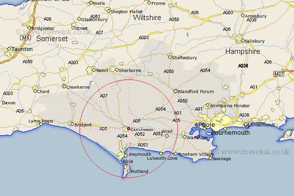
Dorset Map Showing Location of Dorchester
Population: 15104
Area Size (ha): 425
District: West Dorset
Easting: 369411 Northing: 90939
Latitude: 50.72 Longitude: -2.43
 = Dorchester
Area Size (ha): 425
District: West Dorset
Easting: 369411 Northing: 90939
Latitude: 50.72 Longitude: -2.43
= Dorchester
This Dorchester map below is supplied by Google. Use the tools in the top left corner to zoom into street level or zoom out for a road map, you may also need to zoom in to see Dorchester on the map. Click and drag the map to move around. If the map fails to load try and refresh your browser or zoom in or out (+ or -).
Update - it seems Google no longer allow people to use their maps for free! This Dorchester map sometimes loads and sometimes gives a error. I am working on a solution.
Closest 30 Towns or Cities to Dorchester (Population over 500)
Dorchester 0km Charminster 2.19km Broadmayne 5.12km Puddletown 6.94km Piddletown 6.94km Piddletrenthide 7.5km Puddletrenthide 7.5km Preston 7.51km Bincombe 7.51km Overcombe 8.96km Upton 9.17km Cerne Abbas 9.55km Osmington 10.4km Maiden Newton 10.91km Portesham 10.92km Portisham 10.92km Weymouth 11.92km Milborne 11.93km Milborne Saint Andrew 11.93km Milborne St. Andrew 11.93km Milborne St Andrew 11.93km Chickerell 12.07km West Chickerel 12.07km Abbotsbury 12.99km Buckland Newton 13.02km Bovington Camp 13.04km Winfrith 13.89km Winfrith Newburgh 13.89km Milton Abbas 14.04km Wool 15.62km