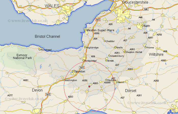
Somerset Map Showing Location of Donyatt
Population: 355
District: South Somerset
Easting: 334398 Northing: 113502
Latitude: 50.92 Longitude: -2.93
 = Donyatt
District: South Somerset
Easting: 334398 Northing: 113502
Latitude: 50.92 Longitude: -2.93
= Donyatt
This Donyatt map below is supplied by Google. Use the tools in the top left corner to zoom into street level or zoom out for a road map, you may also need to zoom in to see Donyatt on the map. Click and drag the map to move around. If the map fails to load try and refresh your browser or zoom in or out (+ or -).
Update - it seems Google no longer allow people to use their maps for free! This Donyatt map sometimes loads and sometimes gives a error. I am working on a solution.
Closest 30 Towns or Cities to Donyatt (Population over 500)
Ilminster 2.18km Broadway 2.98km Ilton 3.88km Combe St. Nicholas 5.03km Combe St Nicholas 5.03km Combe Saint Nicholas 5.03km Chard 6.03km Winsham 7.78km Hatch Beauchamp 8.76km Fivehead 9.34km South Petherton 10.05km Crewkerne 10.06km Misterton 10.88km North Curry 11.36km Curry Rivel 11.66km Kingsbury 11.92km Kingsbury Episcopi 11.92km Creech St. Michael 12.56km Creech St Michael 12.56km Creech Saint Michael 12.56km West Chinnock 12.85km Stoke Saint Gregory 12.97km Stoke St. Gregory 12.97km Stoke St Gregory 12.97km Haselbury Plucknett 12.99km Martock 14km Pitminster 14km Langport 14.74km Montacute 15.63km Trull 15.83km