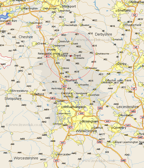
Staffordshire Map Showing Location of Dilhorne
Population: 458
District: Staffordshire Moorlands
Easting: 397763 Northing: 344776
Latitude: 53 Longitude: -2.03
 = Dilhorne
District: Staffordshire Moorlands
Easting: 397763 Northing: 344776
Latitude: 53 Longitude: -2.03
= Dilhorne
This Dilhorne map below is supplied by Google. Use the tools in the top left corner to zoom into street level or zoom out for a road map, you may also need to zoom in to see Dilhorne on the map. Click and drag the map to move around. If the map fails to load try and refresh your browser or zoom in or out (+ or -).
Update - it seems Google no longer allow people to use their maps for free! This Dilhorne map sometimes loads and sometimes gives a error. I am working on a solution.
Closest 30 Towns or Cities to Dilhorne (Population over 500)
Caverswall 2.9km Draycott 3.7km Draycott in the Moors 3.7km Kingsley 3.83km Cheadle 3.83km Cheddleton 5.56km Ipstones 5.8km Fulford 5.99km Oakamoor 7.81km Checkley 9.28km Hilderstone 9.85km Stoke-on-Trent 10.04km Stoke on Trent 10.04km Stoke-upon-Trent 10.04km Stoke 10.04km Stoke upon Trent 10.04km Leigh 10.28km Church Leigh 10.28km Barlaston 10.52km Alton 10.7km Endon 10.81km Leek 11.18km Waterhouses 11.75km Denstone 12.82km Denston 12.82km Stone 12.98km Newcastle-under-Lyme 13.38km Newcastle under Lyme 13.38km Horton 13.4km Rocester 14.5km