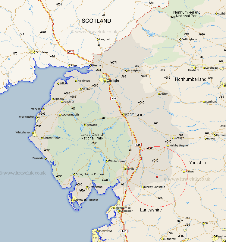
Cumbria Map Showing Location of Dent
Population: 675
District: South Lakeland
Easting: 370694 Northing: 485782
Latitude: 54.27 Longitude: -2.45
 = Dent
District: South Lakeland
Easting: 370694 Northing: 485782
Latitude: 54.27 Longitude: -2.45
= Dent
This Dent map below is supplied by Google. Use the tools in the top left corner to zoom into street level or zoom out for a road map, you may also need to zoom in to see Dent on the map. Click and drag the map to move around. If the map fails to load try and refresh your browser or zoom in or out (+ or -).
Update - it seems Google no longer allow people to use their maps for free! This Dent map sometimes loads and sometimes gives a error. I am working on a solution.
Closest 30 Towns or Cities to Dent (Population over 500)
Sedbergh 7.04km Millthrop 7.04km Milnthorpe 7.04km Kirkby Londsdale 11.41km Kirkby Lonsdale 11.41km Ravenstonedale 16.82km Natland 18.49km Tebay 18.79km Holme 19.66km Kendal 20.25km Kendall 20.25km Heversham 20.91km Milnthorpe 21.32km Levens 21.73km Beetham 21.88km Kirkby Stephen 23.16km Orton 23.48km Staveley 26.25km Arnside 26.59km Crosby Ravensworth 29.11km Brough 29.45km Shap 31.14km Windermere 32.25km Appleby 33.42km Holker 34.84km Lower Holker 34.84km Haverthwaite 37km Long Marston 37.31km Long Marton 37.31km Hawkshead 37.37km