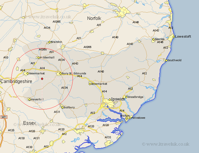
Suffolk Map Showing Location of Denham
Population: 173
District: St. Edmundsbury
Easting: 574181 Northing: 260718
Latitude: 52.22 Longitude: 0.55
 = Denham
District: St. Edmundsbury
Easting: 574181 Northing: 260718
Latitude: 52.22 Longitude: 0.55
= Denham
This Denham map below is supplied by Google. Use the tools in the top left corner to zoom into street level or zoom out for a road map, you may also need to zoom in to see Denham on the map. Click and drag the map to move around. If the map fails to load try and refresh your browser or zoom in or out (+ or -).
Update - it seems Google no longer allow people to use their maps for free! This Denham map sometimes loads and sometimes gives a error. I am working on a solution.
Closest 30 Towns or Cities to Denham (Population over 500)
Barrow 2.93km Gazeley 4.34km Chevington 4.91km Moulton 5.86km Chedburgh 5.87km Wickhambrook 7.5km Risby 7.94km Newmarket 9.81km Fornham All Saints 11.63km Bury St. Edmunds 11.94km Bury Saint Edmunds 11.94km Bury St Edmunds 11.94km Hundon 12.98km Thurlow 14.36km Lawshall 14.53km Exning 14.71km Rushbrooke 14.76km Mildenhall 14.99km Clare 15.01km Glemsford 15.22km Kedington 15.52km Great Barton 15.76km Cavendish 15.89km Eriswell 16.72km Haverhill 16.83km Bradfield St. George 17.14km Bradfield St George 17.14km Bradfield 17.14km Bradfield Saint George 17.14km Cockfield 17.55km