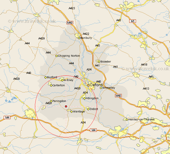
Oxfordshire Map Showing Location of Denchworth
Population: 154
District: Vale of White Horse
Easting: 438075 Northing: 191070
Latitude: 51.62 Longitude: -1.45
 = Denchworth
District: Vale of White Horse
Easting: 438075 Northing: 191070
Latitude: 51.62 Longitude: -1.45
= Denchworth
This Denchworth map below is supplied by Google. Use the tools in the top left corner to zoom into street level or zoom out for a road map, you may also need to zoom in to see Denchworth on the map. Click and drag the map to move around. If the map fails to load try and refresh your browser or zoom in or out (+ or -).
Update - it seems Google no longer allow people to use their maps for free! This Denchworth map sometimes loads and sometimes gives a error. I am working on a solution.
Closest 30 Towns or Cities to Denchworth (Population over 500)
Hanney 3.45km East Hanney 3.45km East Challow 3.71km Stanford in the Vale 3.91km Childrey 4.37km Wantage 5.07km Letcombe Regis 5.56km Kingston Bagpuize 6.02km Kingston Bagpuze 6.02km Buckland 6.54km Longworth 7.49km Uffington 7.84km Marcham 8.86km Steventon 9.21km Faringdon 9.92km Milton 10.36km Drayton 10.52km Standlake 11.35km Harwell 11.66km Bampton 12.52km Abingdon on Thames 12.77km Abingdon-on-Thames 12.77km Abingdon 12.77km Sutton Courtenay 12.79km Watchfield 12.8km Clanfield 13.05km Stanton Harcourt 13.42km Sunningwell 13.68km Cumnor 13.73km Wootton 13.89km