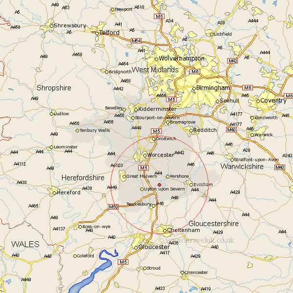
Worcestershire Map Showing Location of Defford
Population: 565
District: Wychavon
Easting: 392006 Northing: 242824
Latitude: 52.08 Longitude: -2.12
 = Defford
District: Wychavon
Easting: 392006 Northing: 242824
Latitude: 52.08 Longitude: -2.12
= Defford
This Defford map below is supplied by Google. Use the tools in the top left corner to zoom into street level or zoom out for a road map, you may also need to zoom in to see Defford on the map. Click and drag the map to move around. If the map fails to load try and refresh your browser or zoom in or out (+ or -).
Update - it seems Google no longer allow people to use their maps for free! This Defford map sometimes loads and sometimes gives a error. I am working on a solution.
Closest 30 Towns or Cities to Defford (Population over 500)
Eckington 1.85km Wadborough 4.36km Pershore 5.05km Bredon 5.56km Upton 7.08km Upton upon Severn 7.08km Upton on Severn 7.08km Upton-on-Severn 7.08km Seven Stoke 7.08km Severn Stoke 7.08km Ripple 7.19km Peopleton 7.5km Fladbury 7.77km Kempsey 7.96km Hanley Castle 7.97km Cropthorne 7.97km Charlton 9.3km Beckford 9.34km Ashton-under-Hill 9.72km Ashton under Hill 9.72km Bishampton 11.52km Sedgeberrow 11.67km Evesham 12.53km Crowle 12.98km Powick 12.99km Welland 13.07km Church Lench 13.58km Castlemorton 13.71km Offenham 13.79km Malvern 14.16km