Hampshire Map Showing Location of Downend
Easting: 454156 Northing: 87419
Latitude: 50.68 Longitude: -1.23
 = Downend
Latitude: 50.68 Longitude: -1.23
= Downend
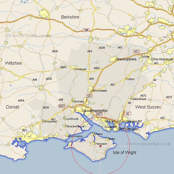
This Downend map below is supplied by Google. Use the tools in the top left corner to zoom into street level or zoom out for a road map, you may also need to zoom in to see Downend on the map. Click and drag the map to move around. If the map fails to load try and refresh your browser or zoom in or out (+ or -).
Update - it seems Google no longer allow people to use their maps for free! This Downend map sometimes loads and sometimes gives a error. I am working on a solution.
Closest 30 Towns or Cities to Downend (Population over 500)
Arreton 2.19km Newchurch 2.99km Wootton 3.71km Newport 3.98km Rookley 5.11km Brading 5.87km Sandown 6.95km Ryde 7.28km Godshill 7.5km Northwood 8.08km Shanklin 8.21km St Helens 8.42km Saint Helens 8.42km St. Helens 8.42km East Cowes 8.77km Wroxall 9.34km Gurnard 9.45km Ventnor 9.91km Jentnor 9.91km Shorwell 9.93km Seaview 10.1km Cowes 10.39km Bembridge 10.57km Niton 11.67km Shalfleet 11.89km Calbourne 11.89km Brightstone 11.95km Brighstone 11.95km Chale 12.58km Lee on Solent 13.18km