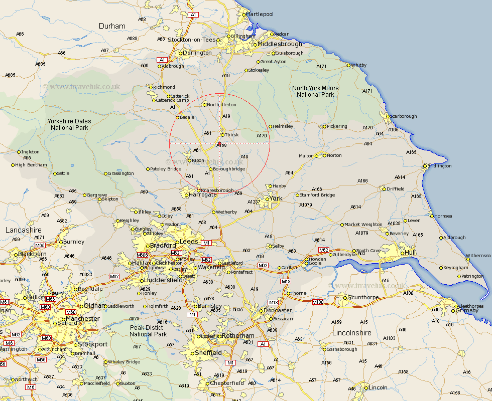
Yorkshire Map Showing Location of Dalton
Population: 498
District: Hambleton
Easting: 442415 Northing: 476605
Latitude: 54.18 Longitude: -1.35
 = Dalton
District: Hambleton
Easting: 442415 Northing: 476605
Latitude: 54.18 Longitude: -1.35
= Dalton
This Dalton map below is supplied by Google. Use the tools in the top left corner to zoom into street level or zoom out for a road map, you may also need to zoom in to see Dalton on the map. Click and drag the map to move around. If the map fails to load try and refresh your browser or zoom in or out (+ or -).
Update - it seems Google no longer allow people to use their maps for free! This Dalton map sometimes loads and sometimes gives a error. I am working on a solution.
Closest 30 Towns or Cities to Dalton (Population over 500)
Topcliffe 2.17km Thirsk 3.87km Dishforth 5.71km Raskelf 8.56km Boroughbridge 11.59km Easingwold 12.26km Marton le Moor 13.01km Marton 13.01km Ripon 13.14km Alne 13.47km West Tanfield 14.22km Tanfield 14.22km Monkton 14.8km Bishop Monkton 14.8km Great Ouseburn 14.98km Ouseburn 14.98km Ampleforth 15.29km Tollerton 15.61km Burton Leonard 16.24km Northallerton 17.54km Stillington 17.8km Linton-on-Ouse 17.91km Linton on Ouse 17.91km Linton 17.91km Linton upon Ouse 17.91km Huby 17.97km Whixley 18.65km Bedale 18.8km Newton upon Ouse 18.81km Newton 18.81km