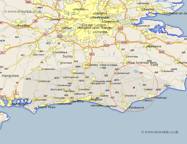
Sussex Map Showing Location of Dallington
Population: 305
District: Rother
Easting: 566280 Northing: 117600
Latitude: 50.93 Longitude: 0.37
 = Dallington
District: Rother
Easting: 566280 Northing: 117600
Latitude: 50.93 Longitude: 0.37
= Dallington
This Dallington map below is supplied by Google. Use the tools in the top left corner to zoom into street level or zoom out for a road map, you may also need to zoom in to see Dallington on the map. Click and drag the map to move around. If the map fails to load try and refresh your browser or zoom in or out (+ or -).
Update - it seems Google no longer allow people to use their maps for free! This Dallington map sometimes loads and sometimes gives a error. I am working on a solution.
Closest 30 Towns or Cities to Dallington (Population over 500)
Warbleton 5.84km Hurstmonceux 6.03km Hurstmonceaux 6.03km Herstmonceux 6.03km Mountfield 7.01km Heathfield 7.25km Burwash 7.51km Catsfield 8.07km Ninfield 8.19km Horeham 8.38km Horam 8.38km Etchingham 8.76km Robertsbridge 8.94km Battle 9.53km Hailsham 10.2km Hurst Green 10.2km Mayfield 11.03km Hellingly 11.04km Ticehurst 11.66km Sedlescombe 11.83km Crowhurst 11.93km Wadhurst 13.18km Chiddingly 13.37km Hadlow Down 13.99km East Hoathly 14.14km Bexhill 14.29km Westfield 14.5km Pevensey Bay 14.82km Pevensey 14.87km Rotherfield 15.29km