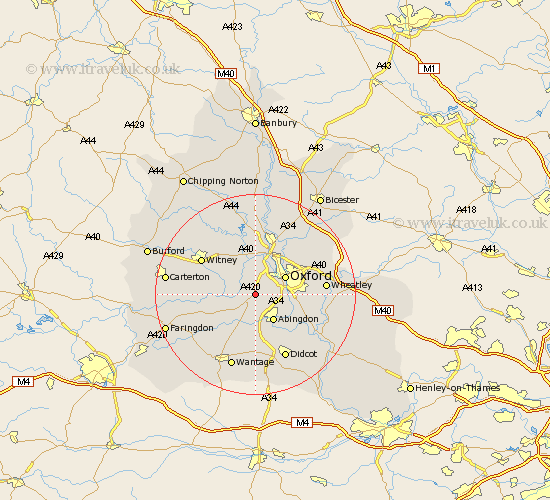
Oxfordshire Map Showing Location of Cumnor
Population: 5503
District: Vale of White Horse
Easting: 446050 Northing: 202258
Latitude: 51.72 Longitude: -1.33
 = Cumnor
District: Vale of White Horse
Easting: 446050 Northing: 202258
Latitude: 51.72 Longitude: -1.33
= Cumnor
This Cumnor map below is supplied by Google. Use the tools in the top left corner to zoom into street level or zoom out for a road map, you may also need to zoom in to see Cumnor on the map. Click and drag the map to move around. If the map fails to load try and refresh your browser or zoom in or out (+ or -).
Update - it seems Google no longer allow people to use their maps for free! This Cumnor map sometimes loads and sometimes gives a error. I am working on a solution.
Closest 30 Towns or Cities to Cumnor (Population over 500)
Wootton 2.95km North Hinksey 3.91km Stanton Harcourt 4.95km Sunningwell 5.07km Standlake 5.74km Ensham 6.54km Eynsham 6.54km Abingdon 6.54km Abingdon on Thames 6.54km Abingdon-on-Thames 6.54km Oxford 6.83km Marcham 7.42km Cassington 7.49km Radley 7.83km Longworth 7.83km Kingston Bagpuize 7.99km Kingston Bagpuze 7.99km Littlemore 8.04km Yarnton 9.54km Drayton 9.55km Church Handborough 9.88km Hanborough 9.88km Sutton Courtenay 10.35km Ducklington 10.97km Bladon 11.18km Steventon 11.18km Milton 11.35km North Leigh 11.54km Long Wittenham 11.56km Kidlington 11.64km