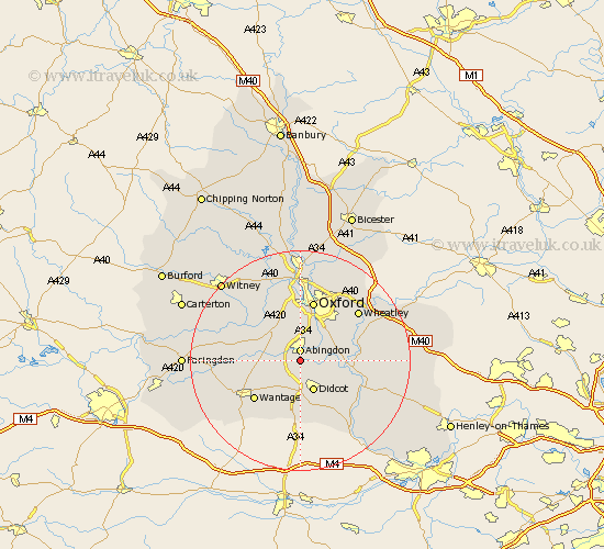
Oxfordshire Map Showing Location of Culham
Population: 415
District: South Oxfordshire
Easting: 449577 Northing: 194873
Latitude: 51.65 Longitude: -1.28
 = Culham
District: South Oxfordshire
Easting: 449577 Northing: 194873
Latitude: 51.65 Longitude: -1.28
= Culham
This Culham map below is supplied by Google. Use the tools in the top left corner to zoom into street level or zoom out for a road map, you may also need to zoom in to see Culham on the map. Click and drag the map to move around. If the map fails to load try and refresh your browser or zoom in or out (+ or -).
Update - it seems Google no longer allow people to use their maps for free! This Culham map sometimes loads and sometimes gives a error. I am working on a solution.
Closest 30 Towns or Cities to Culham (Population over 500)
Abingdon 1.86km Abingdon-on-Thames 1.86km Abingdon on Thames 1.86km Drayton 2.18km Sutton Courtenay 2.18km Marcham 3.45km Sunningwell 3.7km Milton 3.88km Long Wittenham 3.92km Steventon 4.36km Radley 5.06km Harwell 5.56km Wootton 5.68km Clifton Hampden 5.75km Didcot 6.02km Cumnor 8.18km East Hagbourne 8.18km Hagbourne 8.18km Dorchester 8.26km Littlemore 8.73km East Hanney 8.86km Hanney 8.86km North Hinksey 9.26km Kingston Bagpuze 9.38km Kingston Bagpuize 9.38km Drayton St. Leonard 10.35km Drayton Saint Leonard 10.35km Drayton St Leonard 10.35km Drayton 10.35km Stadhampton 10.51km