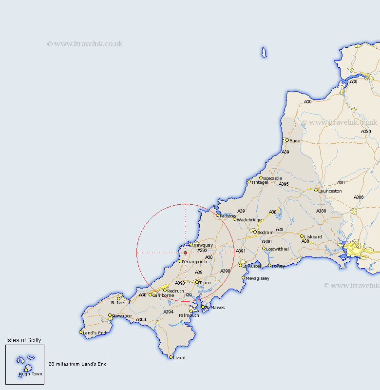
Cornwall Map Showing Location of Cubert
Population: 1155
District: Carrick
Easting: 178459 Northing: 58423
Latitude: 50.38 Longitude: -5.12
 = Cubert
District: Carrick
Easting: 178459 Northing: 58423
Latitude: 50.38 Longitude: -5.12
= Cubert
This Cubert map below is supplied by Google. Use the tools in the top left corner to zoom into street level or zoom out for a road map, you may also need to zoom in to see Cubert on the map. Click and drag the map to move around. If the map fails to load try and refresh your browser or zoom in or out (+ or -).
Update - it seems Google no longer allow people to use their maps for free! This Cubert map sometimes loads and sometimes gives a error. I am working on a solution.
Closest 30 Towns or Cities to Cubert (Population over 500)
Crantock 1.86km Perranporth 4.39km Newquay 4.4km Perranzabuloe 6.04km St Agnes 10.26km St. Agnes 10.26km Saint Agnes 10.26km Kenwyn 13.44km Truro 13.8km Ladock 13.95km Saint Columb 14.13km St Columb Major 14.13km St. Columb 14.13km St. Columb Major 14.13km Saint Columb Major 14.13km St Columb 14.13km Chacewater 15.24km Probus 16.24km St Stephen 16.35km Saint Stephen 16.35km St. Stephen 16.35km St. Dennis 16.54km St Dennis 16.54km St Denis 16.54km St. Denis 16.54km Saint Denis 16.54km Saint Dennis 16.54km St Day 17.34km St. Day 17.34km Saint Day 17.34km