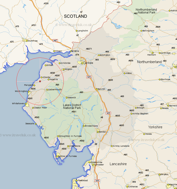
Cumbria Map Showing Location of Crosscanonby
Population: 1054
District: Allerdale
Easting: 307716 Northing: 538545
Latitude: 54.73 Longitude: -3.43
 = Crosscanonby
District: Allerdale
Easting: 307716 Northing: 538545
Latitude: 54.73 Longitude: -3.43
= Crosscanonby
This Crosscanonby map below is supplied by Google. Use the tools in the top left corner to zoom into street level or zoom out for a road map, you may also need to zoom in to see Crosscanonby on the map. Click and drag the map to move around. If the map fails to load try and refresh your browser or zoom in or out (+ or -).
Update - it seems Google no longer allow people to use their maps for free! This Crosscanonby map sometimes loads and sometimes gives a error. I am working on a solution.
Closest 30 Towns or Cities to Crosscanonby (Population over 500)
Dearham 3.7km Maryport 5.66km Broughton Moor 5.96km Aspatria 6.68km Bridekirk 7.02km Flimby 7.72km Cockermouth 9.14km Brigham 9.32km Workington 12.62km Bromfield 13.01km Dean 14.82km Silloth 15.44km Distington 17.88km Lamplugh 18.65km Lowca 19.27km Westward 20.04km Parton 20.89km Wigton 21.3km Kirkbride 22.4km Frizington 22.47km Whitehaven 23.03km Caldbeck 24.61km Cleator Moor 24.67km Koswick 25.19km Keswick 25.19km Hesket Newmarket 26.75km Thursby 26.98km Bowness on Solway 27.8km Bowness-on-Solway 27.8km Saint Bega 28.5km