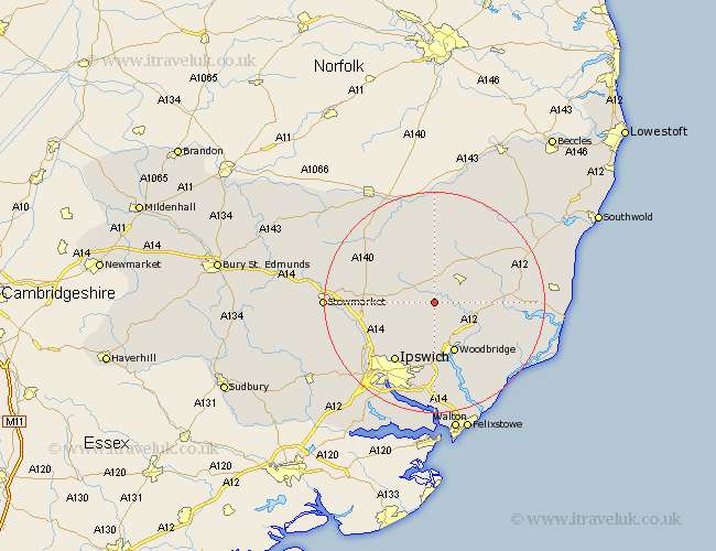
Suffolk Map Showing Location of Cretingham
Population: 193
District: Suffolk Coastal
Easting: 623290 Northing: 258970
Latitude: 52.18 Longitude: 1.27
 = Cretingham
District: Suffolk Coastal
Easting: 623290 Northing: 258970
Latitude: 52.18 Longitude: 1.27
= Cretingham
This Cretingham map below is supplied by Google. Use the tools in the top left corner to zoom into street level or zoom out for a road map, you may also need to zoom in to see Cretingham on the map. Click and drag the map to move around. If the map fails to load try and refresh your browser or zoom in or out (+ or -).
Update - it seems Google no longer allow people to use their maps for free! This Cretingham map sometimes loads and sometimes gives a error. I am working on a solution.
Closest 30 Towns or Cities to Cretingham (Population over 500)
Otley 4.35km Framlingham 5.87km Debenham 6.79km Wickham Market 7.76km Grundisburgh 9.33km Ufford 9.34km Worlingworth 9.34km Dennington 9.55km Melton 9.87km Woodbridge 9.87km Wirnesham 10.87km Witnesham 10.87km Henley 10.87km Martlesham 11.35km Coddenham 11.65km Rendlesham 12.63km Martlesham Heath 13.02km Ipswich 13.05km Tunstall 13.69km Sutton 14.16km Thorndon 14.36km Laxfield 14.65km Great Blakenham 14.67km Stradbroke 14.83km Claydon 15.12km Mendlesham 15.51km Snape 15.91km Saxmundham 16.33km Bucklesham 16.72km Eye 16.83km