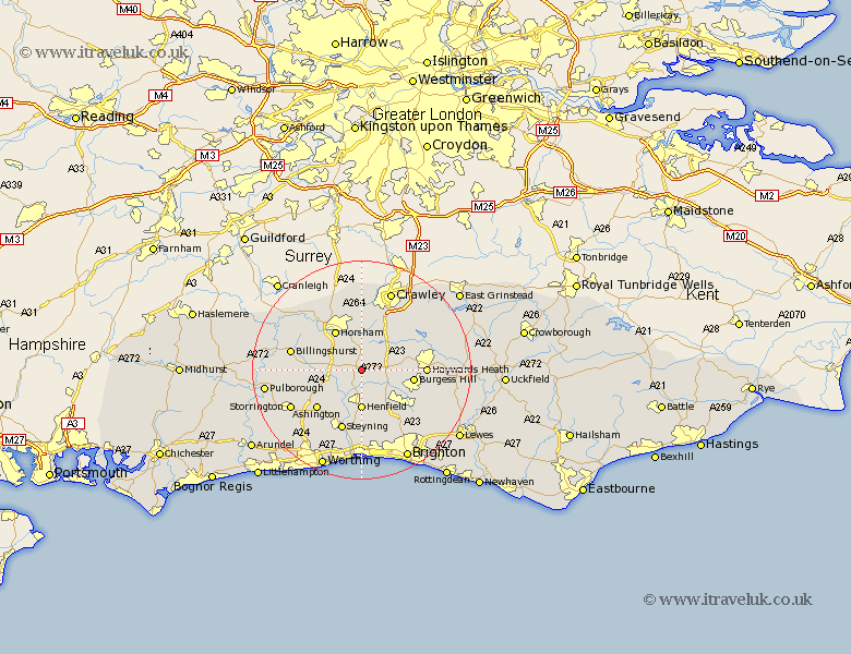
Sussex Map Showing Location of Cowfold
Population: 1563
Area Size (ha): 30
District: Horsham
Easting: 521655 Northing: 121923
Latitude: 50.98 Longitude: -0.27
 = Cowfold
Area Size (ha): 30
District: Horsham
Easting: 521655 Northing: 121923
Latitude: 50.98 Longitude: -0.27
= Cowfold
This Cowfold map below is supplied by Google. Use the tools in the top left corner to zoom into street level or zoom out for a road map, you may also need to zoom in to see Cowfold on the map. Click and drag the map to move around. If the map fails to load try and refresh your browser or zoom in or out (+ or -).
Update - it seems Google no longer allow people to use their maps for free! This Cowfold map sometimes loads and sometimes gives a error. I am working on a solution.
Closest 30 Towns or Cities to Cowfold (Population over 500)
Nuthurst 2.98km Lower Beeding 3.89km Bolney 4.67km Botney 4.67km West Grinstead 5.02km Southwater 6.91km Shipley 7.24km Slaugham 7.26km Henfield 7.41km Albourne 8.06km Horsham 8.76km West Horsham 8.76km Burgess Hill 9.52km Itchingfield 9.88km Cuckfield 10.04km South Nutfield 10.04km Hurstpierpoint 10.19km Ashington 11.03km Steyning 11.66km Upper Beeding 11.66km Bramber 11.66km Upper Bleeding 11.66km Haywards Heath 11.67km Baywards Heath 11.67km Thakeham 11.89km Slinfold 11.92km Hassocks 11.92km Keymer 11.92km Warnham 12.06km Balcombe 12.85km