Durham Map Showing Location of Cornsay
Population: 1187
District: Derwentside
Easting: 415004 Northing: 543190
Latitude: 54.78 Longitude: -1.77
 = Cornsay
District: Derwentside
Easting: 415004 Northing: 543190
Latitude: 54.78 Longitude: -1.77
= Cornsay
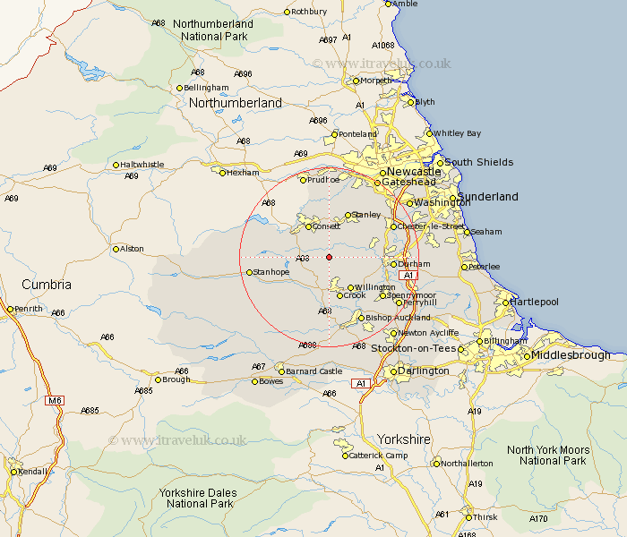
This Cornsay map below is supplied by Google. Use the tools in the top left corner to zoom into street level or zoom out for a road map, you may also need to zoom in to see Cornsay on the map. Click and drag the map to move around. If the map fails to load try and refresh your browser or zoom in or out (+ or -).
Update - it seems Google no longer allow people to use their maps for free! This Cornsay map sometimes loads and sometimes gives a error. I am working on a solution.
Closest 30 Towns or Cities to Cornsay (Population over 500)
Esh 4.27km Lanchester 4.28km Tow Law 6.42km Langley Park 6.67km Ushaw Moor 7.48km Annfield Plain 7.72km Castleside 8.48km Willington 8.55km Consetti 8.56km Consett 8.56km Witton Gilbert 8.75km Crook 9.51km Leadgate 9.52km Sacriston 10.31km Brandon 10.31km Wolsingham 10.53km Stanley 10.69km Edmondsley 11.31km Durham 12.96km Burnopfield 13.37km Pelton 14.14km Spennymoor 14.2km Chester-le-Street 14.81km Etherley 14.86km High Etherley 14.86km Coundon 14.97km Rowlands Gill 14.99km Shincliffe 15.08km Ouston 15.45km Ouston Moor 15.45km