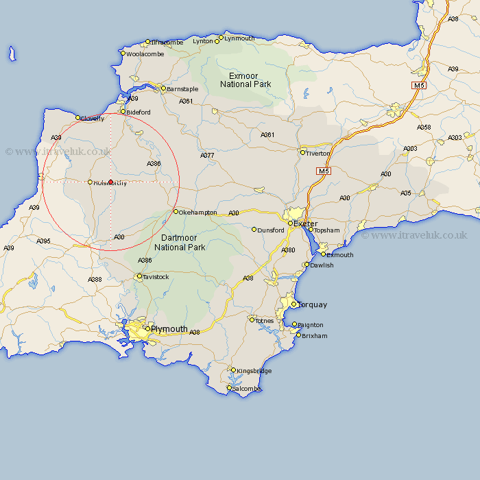
Devon Map Showing Location of Cookbury
Population: 158
District: Torridge
Easting: 240346 Northing: 104416
Latitude: 50.82 Longitude: -4.27
 = Cookbury
District: Torridge
Easting: 240346 Northing: 104416
Latitude: 50.82 Longitude: -4.27
= Cookbury
This Cookbury map below is supplied by Google. Use the tools in the top left corner to zoom into street level or zoom out for a road map, you may also need to zoom in to see Cookbury on the map. Click and drag the map to move around. If the map fails to load try and refresh your browser or zoom in or out (+ or -).
Update - it seems Google no longer allow people to use their maps for free! This Cookbury map sometimes loads and sometimes gives a error. I am working on a solution.
Closest 30 Towns or Cities to Cookbury (Population over 500)
Shebbear 5.1km Black Torrington 5.85km Holsworthy 5.85km Halwill 6.03km Ashwater 9.35km Pyworthy 9.55km Bridgerule 11.86km Northlew 11.92km Langtree 12.06km Bradworthy 12.36km Hatherleigh 14.05km Broadwoodwidger 14.88km St Giles-on-the-Heath 15.56km St Giles on the Heath 15.56km Saint Giles 15.56km St. Giles 15.56km St. Giles on the Heath 15.56km St. Giles-on-the-Heath 15.56km Saint Giles-on-the-Heath 15.56km St Giles 15.56km Saint Giles on the Heath 15.56km Buckland Brewer 16.72km Parkham 16.84km Great Torrington 16.93km Torrington 16.93km Dolton 17.98km Woolfardisworthy 18.58km Woolsery 18.58km Bridestowe 18.91km Lifton 20.43km