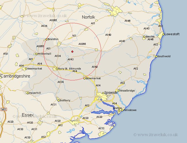
Suffolk Map Showing Location of Coney Weston
Population: 379
District: St. Edmundsbury
Easting: 595146 Northing: 278204
Latitude: 52.37 Longitude: 0.87
 = Coney Weston
District: St. Edmundsbury
Easting: 595146 Northing: 278204
Latitude: 52.37 Longitude: 0.87
= Coney Weston
This Coney Weston map below is supplied by Google. Use the tools in the top left corner to zoom into street level or zoom out for a road map, you may also need to zoom in to see Coney Weston on the map. Click and drag the map to move around. If the map fails to load try and refresh your browser or zoom in or out (+ or -).
Update - it seems Google no longer allow people to use their maps for free! This Coney Weston map sometimes loads and sometimes gives a error. I am working on a solution.
Closest 30 Towns or Cities to Coney Weston (Population over 500)
Barningham 2.93km Hopton 4.53km Hepworth 5.03km Bardwell 5.67km Honington 5.86km Stanton 6km Ixworth 7.76km Troston 7.93km Barnham 9.05km Redgrave 9.05km Badwell Ash 9.88km Botesdale 10.84km Pakenham 11.35km Wortham 12.59km Norton 12.98km Great Barton 13.03km Thurston 13.41km Gislingham 14.5km Bacton 15.09km Elmswell 15.22km Fornham All Saints 15.87km Bury St. Edmunds 16.5km Bury Saint Edmunds 16.5km Bury St Edmunds 16.5km Woolpit 16.83km Rushbrooke 18.01km Haughley 18.47km Mendlesham 18.8km Bradfield 19.08km Bradfield St. George 19.08km