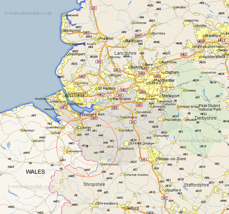
Cheshire Map Showing Location of Coddington
Population: 78
District: Chester
Easting: 345304 Northing: 354353
Latitude: 53.08 Longitude: -2.82
 = Coddington
District: Chester
Easting: 345304 Northing: 354353
Latitude: 53.08 Longitude: -2.82
= Coddington
This Coddington map below is supplied by Google. Use the tools in the top left corner to zoom into street level or zoom out for a road map, you may also need to zoom in to see Coddington on the map. Click and drag the map to move around. If the map fails to load try and refresh your browser or zoom in or out (+ or -).
Update - it seems Google no longer allow people to use their maps for free! This Coddington map sometimes loads and sometimes gives a error. I am working on a solution.
Closest 30 Towns or Cities to Coddington (Population over 500)
Tilston 3.7km Farndon 4.45km Harthill 4.45km Tattenhall 4.99km Malpas 8.12km Waverton 9.34km Dodleston 10.49km Christleton 11.17km Bunbury 11.73km Tarporley 12.46km Great Barrow 13.02km Barrow 13.02km Tarvin 13.4km Chester 14.59km Mickle Trafford 14.83km Ashton 15.84km Wrenbury 16.27km Wrenbury cum Frith 16.27km Great Saughall 17.29km Saughall 17.29km Kelsall Hill 17.29km Kelshall Hill 17.29km Kelsall 17.29km Delamere 17.89km Mollington 17.96km Little Budworth 18.24km Elton 18.54km Dunham on the Hill 18.57km Dunham-on-the-Hill 18.57km Dunham 18.57km