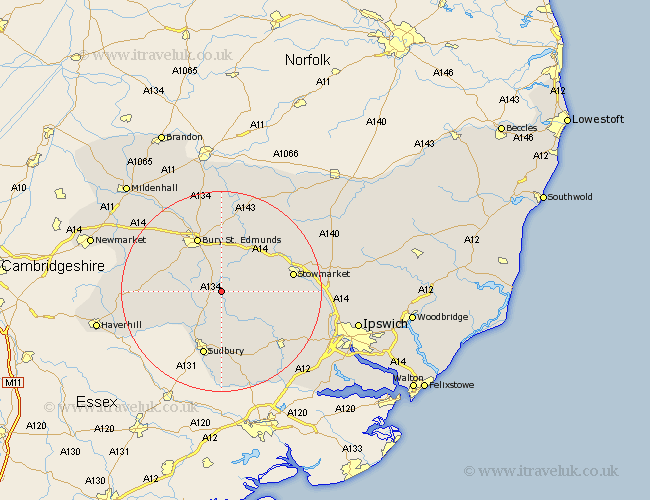
Suffolk Map Showing Location of Cockfield
Population: 839
District: Babergh
Easting: 590401 Northing: 253888
Latitude: 52.15 Longitude: 0.78
 = Cockfield
District: Babergh
Easting: 590401 Northing: 253888
Latitude: 52.15 Longitude: 0.78
= Cockfield
This Cockfield map below is supplied by Google. Use the tools in the top left corner to zoom into street level or zoom out for a road map, you may also need to zoom in to see Cockfield on the map. Click and drag the map to move around. If the map fails to load try and refresh your browser or zoom in or out (+ or -).
Update - it seems Google no longer allow people to use their maps for free! This Cockfield map sometimes loads and sometimes gives a error. I am working on a solution.
Closest 30 Towns or Cities to Cockfield (Population over 500)
Lawshall 3.41km Lavenham 5.67km Bradfield 5.68km Bradfield St. George 5.68km Bradfield Saint George 5.68km Bradfield St George 5.68km Rushbrooke 7.5km Rattlesden 7.76km Hitcham 8.78km Waldingfield 9.26km Great Waldingfield 9.26km Glemsford 9.71km Long Melford 10.32km Great Finborough 10.4km Finborough 10.4km Bildeston 10.66km Woolpit 10.88km Thurston 11.35km Chedburgh 11.96km Bury St. Edmunds 12.01km Bury Saint Edmunds 12.01km Bury St Edmunds 12.01km Norton 12.49km Cavendish 12.65km Chevington 12.65km Elmswell 12.98km Great Cornard 13.03km Great Barton 13.03km Pakenham 13.42km Sudbury 13.42km