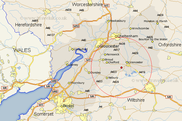
Gloucestershire Map Showing Location of Coates
Population: 477
District: Cotswold
Easting: 397696 Northing: 200191
Latitude: 51.7 Longitude: -2.03
 = Coates
District: Cotswold
Easting: 397696 Northing: 200191
Latitude: 51.7 Longitude: -2.03
= Coates
This Coates map below is supplied by Google. Use the tools in the top left corner to zoom into street level or zoom out for a road map, you may also need to zoom in to see Coates on the map. Click and drag the map to move around. If the map fails to load try and refresh your browser or zoom in or out (+ or -).
Update - it seems Google no longer allow people to use their maps for free! This Coates map sometimes loads and sometimes gives a error. I am working on a solution.
Closest 30 Towns or Cities to Coates (Population over 500)
Cicester 5.06km Cirencester 5.06km Siddington 6.04km North Cerney 8.72km Cerney 8.85km South Cerney 8.85km Minchinhampton 9.19km Avening 9.38km Chalford 9.9km Ampney St. Peter 10.34km Ampney 10.34km Ampney St Peter 10.34km Ampney Saint Peter 10.34km Nailsworth 11.64km Tetbury 11.81km Stroud 12.76km Chedworth 13.72km Painswick 13.87km Woodchester 13.9km Horsley 13.91km Withington 15.89km Bibury 15.93km Randwick 16.66km Fairford 17.23km Quenington 17.33km Stonehouse 18.1km Charlton Kings 18.68km Kempsford 18.75km Leckhampton 18.85km Brockworth 19.04km