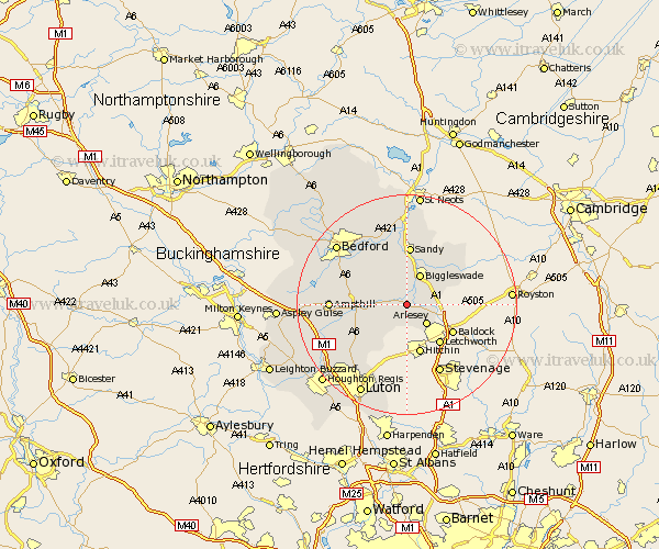
Bedfordshire Map Showing Location of Clifton
Population: 2730
District: Mid Bedfordshire
Easting: 516603 Northing: 238621
Latitude: 52.03 Longitude: -0.3
 = Clifton
District: Mid Bedfordshire
Easting: 516603 Northing: 238621
Latitude: 52.03 Longitude: -0.3
= Clifton
This Clifton map below is supplied by Google. Use the tools in the top left corner to zoom into street level or zoom out for a road map, you may also need to zoom in to see Clifton on the map. Click and drag the map to move around. If the map fails to load try and refresh your browser or zoom in or out (+ or -).
Update - it seems Google no longer allow people to use their maps for free! This Clifton map sometimes loads and sometimes gives a error. I am working on a solution.
Closest 30 Towns or Cities to Clifton (Population over 500)
Southill 1.86km Henlow 2.17km Shefford 2.28km Langford 2.94km Stondon 3.87km Meppershall 4.35km Campton and Chicksands 4.56km Arlesey 5.04km Arlesley 5.04km Gravenhurst 5.88km Biggleswade 6.01km Shillington 6.53km Stotfold 6.8km Northill 7.5km Haynes 8.19km Clophill 8.19km Silsoe 8.8km Wilstead 9.84km Wilshamstead 9.84km Willshamstead 9.84km Wilhamstead 9.84km Maulden 10.43km Sandy 10.73km Cople 10.88km Flitton 10.91km Blunham 11.18km Potton 11.52km Houghton Conquest 11.55km Pulloxhill 11.68km Willington 12.02km