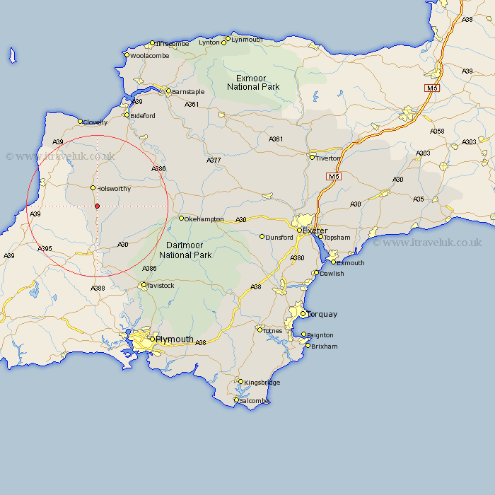
Devon Map Showing Location of Clawton
Population: 326
District: Torridge
Easting: 235476 Northing: 99004
Latitude: 50.77 Longitude: -4.33
 = Clawton
District: Torridge
Easting: 235476 Northing: 99004
Latitude: 50.77 Longitude: -4.33
= Clawton
This Clawton map below is supplied by Google. Use the tools in the top left corner to zoom into street level or zoom out for a road map, you may also need to zoom in to see Clawton on the map. Click and drag the map to move around. If the map fails to load try and refresh your browser or zoom in or out (+ or -).
Update - it seems Google no longer allow people to use their maps for free! This Clawton map sometimes loads and sometimes gives a error. I am working on a solution.
Closest 30 Towns or Cities to Clawton (Population over 500)
Ashwater 5.12km Holsworthy 5.68km Pyworthy 5.97km Halwill 7.03km Bridgerule 7.95km St. Giles-on-the-Heath 9.27km St. Giles 9.27km Saint Giles-on-the-Heath 9.27km St. Giles on the Heath 9.27km St Giles 9.27km Saint Giles on the Heath 9.27km St Giles-on-the-Heath 9.27km Saint Giles 9.27km St Giles on the Heath 9.27km Broadwoodwidger 10.97km Black Torrington 11.92km Shebbear 12.37km Bradworthy 15.23km Northlew 15.24km Lifton 15.25km Bridestowe 18.86km Langtree 19.13km Milton Abbot 19.44km Hatherleigh 19.55km Parkham 22.36km Woolfardisworthy 22.51km Woolsery 22.51km Buckland Brewer 22.99km Okehampton 23.74km Torrington 24.1km