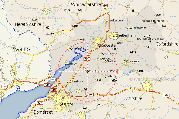
Gloucestershire Map Showing Location of Dursley
Population: 13007
Area Size (ha): 377
District: Stroud
Easting: 376949 Northing: 196540
Latitude: 51.67 Longitude: -2.33
 = Dursley
Area Size (ha): 377
District: Stroud
Easting: 376949 Northing: 196540
Latitude: 51.67 Longitude: -2.33
= Dursley
This Dursley map below is supplied by Google. Use the tools in the top left corner to zoom into street level or zoom out for a road map, you may also need to zoom in to see Dursley on the map. Click and drag the map to move around. If the map fails to load try and refresh your browser or zoom in or out (+ or -).
Update - it seems Google no longer allow people to use their maps for free! This Dursley map sometimes loads and sometimes gives a error. I am working on a solution.
Closest 30 Towns or Cities to Dursley (Population over 500)
Uley 2.17km North Nibley 3.45km Cam 3.88km Wotton-under-Edge 3.88km Wotton under Edge 3.88km Coaley 5.56km Slimbridge 6.54km Horsley 7.14km Charfield 8km Berkeley 8.25km Woodchester 8.86km Falfield 8.86km Hawkesbury 9.27km Nailsworth 9.38km Stone 9.38km Cromhall 9.78km Stonehouse 9.88km Wickwar 9.89km Frampton-on-Severn 11.35km Frampton 11.35km Frampton on Severn 11.35km Avening 11.64km Minchinhampton 12.07km Tetbury 12.08km Randwick 12.51km Tytherington 12.74km Stroud 13.04km Awre 13.08km Chalford 13.67km Rangeworthy 13.73km