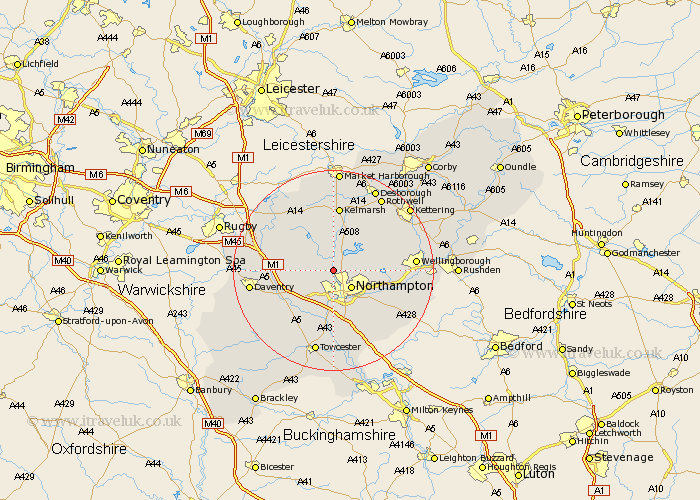
Northamptonshire Map Showing Location of Church Brampton
Population: 251
District: Daventry
Easting: 472756 Northing: 265596
Latitude: 52.28 Longitude: -0.93
 = Church Brampton
District: Daventry
Easting: 472756 Northing: 265596
Latitude: 52.28 Longitude: -0.93
= Church Brampton
This Church Brampton map below is supplied by Google. Use the tools in the top left corner to zoom into street level or zoom out for a road map, you may also need to zoom in to see Church Brampton on the map. Click and drag the map to move around. If the map fails to load try and refresh your browser or zoom in or out (+ or -).
Update - it seems Google no longer allow people to use their maps for free! This Church Brampton map sometimes loads and sometimes gives a error. I am working on a solution.
Closest 30 Towns or Cities to Church Brampton (Population over 500)
Boughton 2.27km Pitsford 3.87km Spratton 3.88km Brixworth 4.35km Northampton 5.03km Moulton 5.67km East Haddon 5.96km Harpole 6.52km Guilsborough 7.17km Kislingbury 7.74km Overstone 7.94km Great Billing 8.76km Billing 8.76km Long Buckby 9.26km Walgrave 9.69km Flore 9.69km Hardingstone 9.87km Great Houghton 10.06km Houghton 10.06km Sywell 10.2km West Haddon 10.64km Bugbrooke 10.86km Milton 11.18km Collingtree 11.35km Naseby 11.63km Wootton 11.63km Weedon Beck 11.72km Weedon 11.72km Blisworth 12.96km Earls Barton 13.01km