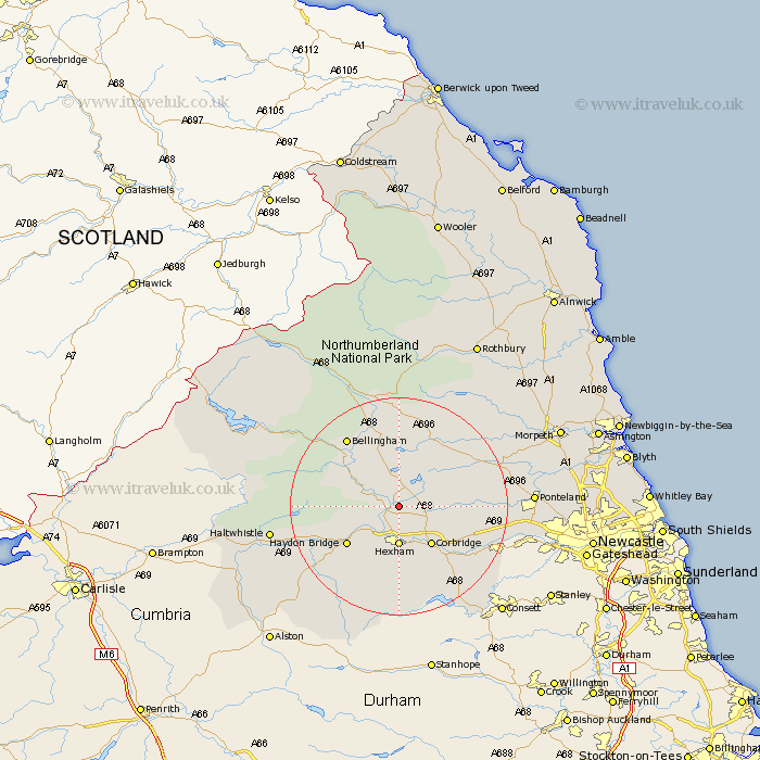
Northumberland Map Showing Location of Chollerton
Population: 797
District: Tynedale
Easting: 393609 Northing: 570987
Latitude: 55.03 Longitude: -2.1
 = Chollerton
District: Tynedale
Easting: 393609 Northing: 570987
Latitude: 55.03 Longitude: -2.1
= Chollerton
This Chollerton map below is supplied by Google. Use the tools in the top left corner to zoom into street level or zoom out for a road map, you may also need to zoom in to see Chollerton on the map. Click and drag the map to move around. If the map fails to load try and refresh your browser or zoom in or out (+ or -).
Update - it seems Google no longer allow people to use their maps for free! This Chollerton map sometimes loads and sometimes gives a error. I am working on a solution.
Closest 30 Towns or Cities to Chollerton (Population over 500)
Chollerton 0km Challerton 0km Humshaugh 2.12km Acomb 5.56km Warden 5.95km Sandhoe 6.41km Newbrough 6.48km Hexham 7.41km Wark 8.31km Corbridge 9.11km Haydon Bridge 11.28km Riding 14km Ridingmill 14km Stamfordham 14.87km Slaley 15.42km Bellingham 15.5km Stocksfield 16.14km Ovingham 16.62km Wylam 17.58km Prudhoe 18.44km Otterburn 20.83km Haltwhistle 21.97km Ponteland 22.38km Newburn 24.53km Dinnington 26.61km Woolsington 26.62km Stannington 28.57km Morpeth 30.38km Longhorsley 30.72km Gosforth 31.03km