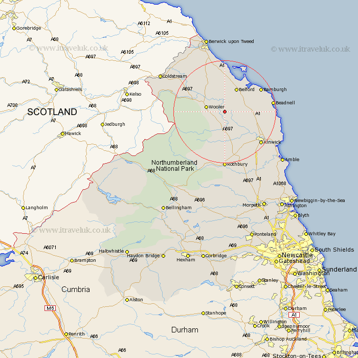
Northumberland Map Showing Location of Chillingham
Population: 50
District: Berwick-upon-Tweed
Easting: 406313 Northing: 624777
Latitude: 55.52 Longitude: -1.9
 = Chillingham
District: Berwick-upon-Tweed
Easting: 406313 Northing: 624777
Latitude: 55.52 Longitude: -1.9
= Chillingham
This Chillingham map below is supplied by Google. Use the tools in the top left corner to zoom into street level or zoom out for a road map, you may also need to zoom in to see Chillingham on the map. Click and drag the map to move around. If the map fails to load try and refresh your browser or zoom in or out (+ or -).
Update - it seems Google no longer allow people to use their maps for free! This Chillingham map sometimes loads and sometimes gives a error. I am working on a solution.
Closest 30 Towns or Cities to Chillingham (Population over 500)
Wooler 6.56km Belford 10.17km Lowick 13.63km North Sunderland 15.7km Beadnell 17.19km Alnwick 18.09km Almwick 18.09km Embleton 18.23km Ancroft 21.33km Shilbottle 21.56km Rothbury 22.24km Alnmouth 22.94km Lisburg 23.22km Lesbury 23.22km Warkworth 25.75km Swarland 26.29km Ord 26.96km East Ord 26.96km Longframlington 26.98km Norham 27.22km Amble 28.55km Felton 28.86km East Thirston 29.34km Thirston 29.34km Berwick-on-Tweed 30.3km Berwick upon Tweed 30.3km Berwick-Upon-Tweed 30.3km Berwick on Tweed 30.3km Berwick 30.3km Berwick-upon-Tweed 30.3km