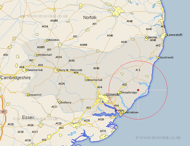
Suffolk Map Showing Location of Chillesford
Population: 126
District: Suffolk Coastal
Easting: 638451 Northing: 252256
Latitude: 52.12 Longitude: 1.48
 = Chillesford
District: Suffolk Coastal
Easting: 638451 Northing: 252256
Latitude: 52.12 Longitude: 1.48
= Chillesford
This Chillesford map below is supplied by Google. Use the tools in the top left corner to zoom into street level or zoom out for a road map, you may also need to zoom in to see Chillesford on the map. Click and drag the map to move around. If the map fails to load try and refresh your browser or zoom in or out (+ or -).
Update - it seems Google no longer allow people to use their maps for free! This Chillesford map sometimes loads and sometimes gives a error. I am working on a solution.
Closest 30 Towns or Cities to Chillesford (Population over 500)
Tunstall 2.93km Rendlesham 4.55km Orford 5.04km Snape 7.49km Hollesley 8.17km Wickham Market 8.78km Aldeburgh 8.78km Ufford 9.1km Thorpeness 10.66km Thorpe 10.66km Sutton 10.67km Leiston 10.87km Saxmundham 11.18km Woodbridge 11.53km Melton 11.53km Martlesham 13.06km Martlesham Heath 14.75km Framlingham 15.11km Grundisburgh 16.04km Yoxford 16.83km Kirkton 17.27km Kirton 17.27km Otley 17.46km Bucklesham 18.45km Felixstowe 19.01km Walton 20.07km Nacton 20.39km Witnesham 20.57km Wirnesham 20.57km Dennington 20.84km