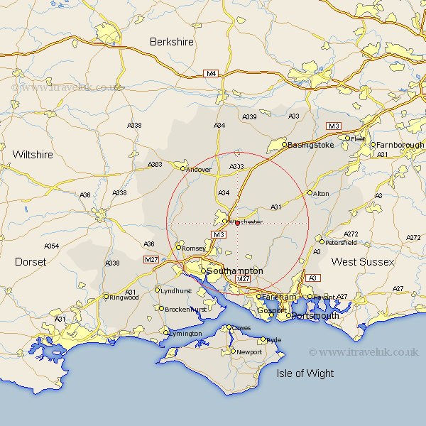
Hampshire Map Showing Location of Chilcomb
Population: 91
District: Winchester
Easting: 451396 Northing: 128165
Latitude: 51.05 Longitude: -1.27
 = Chilcomb
District: Winchester
Easting: 451396 Northing: 128165
Latitude: 51.05 Longitude: -1.27
= Chilcomb
This Chilcomb map below is supplied by Google. Use the tools in the top left corner to zoom into street level or zoom out for a road map, you may also need to zoom in to see Chilcomb on the map. Click and drag the map to move around. If the map fails to load try and refresh your browser or zoom in or out (+ or -).
Update - it seems Google no longer allow people to use their maps for free! This Chilcomb map sometimes loads and sometimes gives a error. I am working on a solution.
Closest 30 Towns or Cities to Chilcomb (Population over 500)
Winchester 3.57km Kings Worthy 4.37km Twyford 5.09km Owslebury 5.56km Compton 5.95km Cheriton 6.99km New Alresford 7.91km Otterbourne 8.05km Sparsholt 8.36km Micheldever 9.26km Upham 9.55km Hursley 10.03km Bishopstoke 10.37km Bramdean 10.65km Eastleigh 10.94km Durley 11.18km Wonston 11.65km Bishop's Waltham 11.66km Bishops Waltham 11.66km Ropley 12.95km Corhampton 13.15km West Meon 13.34km Droxford 14.52km Barton Stacey 14.74km Swanmore 14.74km Botley 14.82km Curbridge 14.87km Curdridge 14.87km Kings Somborne 15.26km Chilworth 15.29km