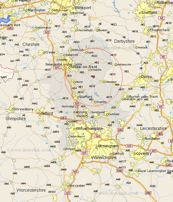
Staffordshire Map Showing Location of Checkley
Population: 4248
District: Staffordshire Moorlands
Easting: 403360 Northing: 337358
Latitude: 52.93 Longitude: -1.95
 = Checkley
District: Staffordshire Moorlands
Easting: 403360 Northing: 337358
Latitude: 52.93 Longitude: -1.95
= Checkley
This Checkley map below is supplied by Google. Use the tools in the top left corner to zoom into street level or zoom out for a road map, you may also need to zoom in to see Checkley on the map. Click and drag the map to move around. If the map fails to load try and refresh your browser or zoom in or out (+ or -).
Update - it seems Google no longer allow people to use their maps for free! This Checkley map sometimes loads and sometimes gives a error. I am working on a solution.
Closest 30 Towns or Cities to Checkley (Population over 500)
Church Leigh 2.16km Leigh 2.16km Alton 5.81km Cheadle 5.99km Draycott 6.71km Draycott in the Moors 6.71km Uttoxeter 7.66km Denston 7.66km Denstone 7.66km Oakamoor 7.75km Fulford 8.04km Rocester 8.04km Hilderstone 9.13km Kingsley 9.54km Caverswall 9.59km Ipstones 11.17km Weston 11.98km Weston upon Trent 11.98km Waterhouses 12.44km Marchington 12.49km Stone 12.84km Abbots Bromley 13.72km Cheddleton 14.12km Mayfield 14.34km Barlaston 14.64km Hopton 15km Colwich 16.83km Stoke-upon-Trent 17.3km Stoke 17.3km Stoke upon Trent 17.3km