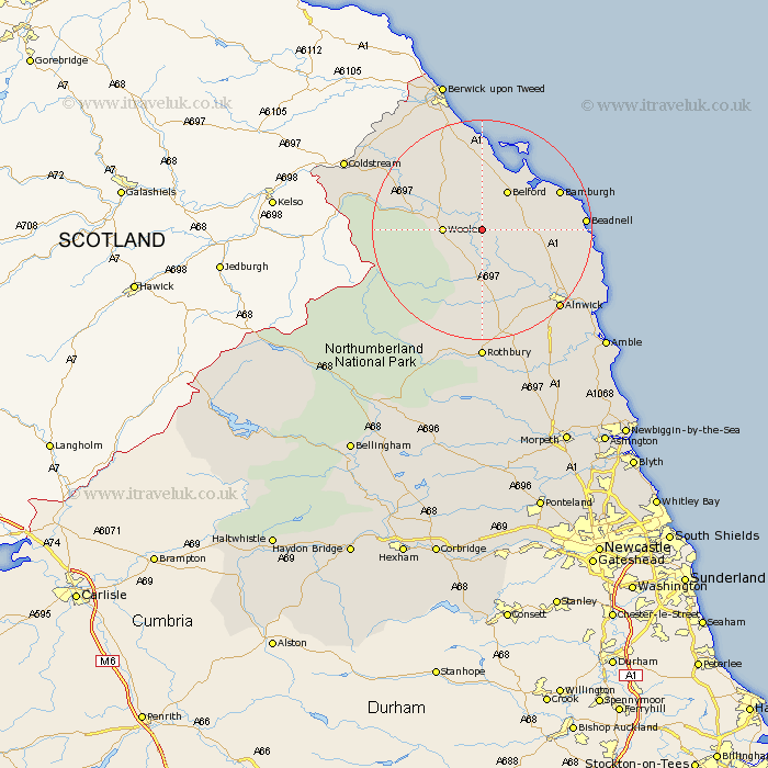
Northumberland Map Showing Location of Chatton
Population: 438
District: Berwick-upon-Tweed
Easting: 406311 Northing: 626624
Latitude: 55.53 Longitude: -1.9
 = Chatton
District: Berwick-upon-Tweed
Easting: 406311 Northing: 626624
Latitude: 55.53 Longitude: -1.9
= Chatton
This Chatton map below is supplied by Google. Use the tools in the top left corner to zoom into street level or zoom out for a road map, you may also need to zoom in to see Chatton on the map. Click and drag the map to move around. If the map fails to load try and refresh your browser or zoom in or out (+ or -).
Update - it seems Google no longer allow people to use their maps for free! This Chatton map sometimes loads and sometimes gives a error. I am working on a solution.
Closest 30 Towns or Cities to Chatton (Population over 500)
Wooler 6.29km Belford 8.52km Lowick 11.88km North Sunderland 15.14km Beadnell 16.88km Embleton 18.69km Alnwick 19.46km Almwick 19.46km Ancroft 19.57km Shilbottle 23.02km Alnmouth 24.03km Rothbury 24.08km Lesbury 24.44km Lisburg 24.44km East Ord 25.18km Ord 25.18km Norham 25.73km Warkworth 27.11km Swarland 27.99km Berwick-on-Tweed 28.5km Berwick 28.5km Berwick-upon-Tweed 28.5km Berwick upon Tweed 28.5km Berwick-Upon-Tweed 28.5km Berwick on Tweed 28.5km Longframlington 28.76km Amble 29.89km Felton 30.53km Thirston 30.98km East Thirston 30.98km