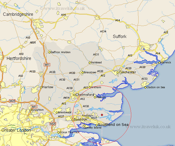
Essex Map Showing Location of Canewdon
Population: 1477
District: Rochford
Easting: 590432 Northing: 192652
Latitude: 51.6 Longitude: 0.75
 = Canewdon
District: Rochford
Easting: 590432 Northing: 192652
Latitude: 51.6 Longitude: 0.75
= Canewdon
This Canewdon map below is supplied by Google. Use the tools in the top left corner to zoom into street level or zoom out for a road map, you may also need to zoom in to see Canewdon on the map. Click and drag the map to move around. If the map fails to load try and refresh your browser or zoom in or out (+ or -).
Update - it seems Google no longer allow people to use their maps for free! This Canewdon map sometimes loads and sometimes gives a error. I am working on a solution.
Closest 30 Towns or Cities to Canewdon (Population over 500)
Rochford 2.96km Barling 4.36km Althorne 5.56km North Fambridge 5.91km Fambridge 5.91km Mayland 6.02km Little Wakering 6.02km Burnham on Crouch 6.05km Burnham-on-Crouch 6.05km Burnham 6.05km Hawkwell 6.05km Hockley 7.15km Latchingdon 7.51km Snoreham 7.51km Latchingdon and Snoreham 7.51km Southminster 8km Leigh on Sea 8.01km Leigh-on-Sea 8.01km Leigh 8.01km Southend 8.18km Southend on Sea 8.18km Southend-on-Sea 8.18km Great Wakering 8.18km Cold Norton 9.39km Rayleigh 9.4km Purleigh 10.13km Woodham Ferrers 11.75km Rawreth 12.66km Tillingham 13.06km Canvey Island 13.7km