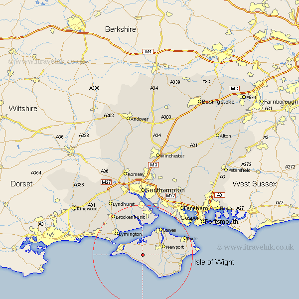
Hampshire Map Showing Location of Calbourne
Population: 821
Easting: 442398 Northing: 85461
Latitude: 50.67 Longitude: -1.4
 = Calbourne
Easting: 442398 Northing: 85461
Latitude: 50.67 Longitude: -1.4
= Calbourne
This Calbourne map below is supplied by Google. Use the tools in the top left corner to zoom into street level or zoom out for a road map, you may also need to zoom in to see Calbourne on the map. Click and drag the map to move around. If the map fails to load try and refresh your browser or zoom in or out (+ or -).
Update - it seems Google no longer allow people to use their maps for free! This Calbourne map sometimes loads and sometimes gives a error. I am working on a solution.
Closest 30 Towns or Cities to Calbourne (Population over 500)
Shalfleet 3.7km Brighstone 3.9km Brightstone 3.9km Shorwell 5.12km Yarmouth 7.96km Freshwater 8.22km Rookley 8.43km Newport 9.01km Totland 9.4km Northwood 9.45km Arreton 10.57km Gurnard 10.96km Chale 10.98km East Cowes 11.64km Godshill 11.95km Niton 12.4km Wootton 12.99km Cowes 13.16km Lymington 14.05km Newchurch 14.1km Boldre 14.55km Wroxall 14.91km Milford 15.05km Milford-on-Sea 15.05km Milford on Sea 15.05km Shanklin 16.26km Hordle 16.86km Ventnor 16.99km Jentnor 16.99km Fawley 17.05km