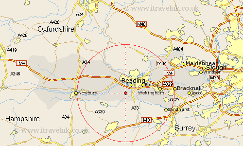
Berkshire Map Showing Location of Burghfield
Population: 5894
Easting: 467238 Northing: 167272
Latitude: 51.4 Longitude: -1.03
 = Burghfield
Easting: 467238 Northing: 167272
Latitude: 51.4 Longitude: -1.03
= Burghfield
This Burghfield map below is supplied by Google. Use the tools in the top left corner to zoom into street level or zoom out for a road map, you may also need to zoom in to see Burghfield on the map. Click and drag the map to move around. If the map fails to load try and refresh your browser or zoom in or out (+ or -).
Update - it seems Google no longer allow people to use their maps for free! This Burghfield map sometimes loads and sometimes gives a error. I am working on a solution.
Closest 30 Towns or Cities to Burghfield (Population over 500)
Mortimer 3.88km Stratfield Mortimer 3.88km Reading 4.37km Theale 4.37km Tilehurst 5.56km Shinfield 5.78km Swallowfield 6.87km Bradfield 7.86km Earley 7.86km Arborfield 8.09km Aberfield 8.09km Beenham 8.3km Aldermaston 8.3km Pangbourne 9.89km Barkham 10.57km Brimpton 11.05km Winnersh 11.71km Woodley 11.79km Sonning 11.85km Bucklebury 12.14km Basildon 12.53km Finchampstead 13.89km Wokingham 14km Twyford 14.71km Wargrave 14.81km Wagrave 14.81km Cold Ash 15.14km Streatley 15.29km Crowthorne 15.49km Thatcham 16.19km