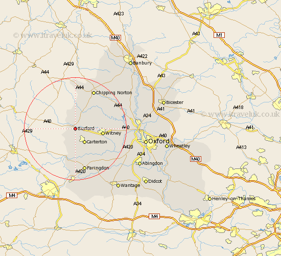
Oxfordshire Map Showing Location of Burford
Population: 1296
Area Size (ha): 60
District: West Oxfordshire
Easting: 425281 Northing: 211375
Latitude: 51.8 Longitude: -1.63
 = Burford
Area Size (ha): 60
District: West Oxfordshire
Easting: 425281 Northing: 211375
Latitude: 51.8 Longitude: -1.63
= Burford
This Burford map below is supplied by Google. Use the tools in the top left corner to zoom into street level or zoom out for a road map, you may also need to zoom in to see Burford on the map. Click and drag the map to move around. If the map fails to load try and refresh your browser or zoom in or out (+ or -).
Update - it seems Google no longer allow people to use their maps for free! This Burford map sometimes loads and sometimes gives a error. I am working on a solution.
Closest 30 Towns or Cities to Burford (Population over 500)
Shilton 4.36km Brize Norton 5.9km Shipton 6.54km Shipton-under-Wychwood 6.54km Shipton under Wychwood 6.54km Carterton 6.54km Minster Lovell 6.88km Leafield 7.12km Hailey 10.31km Witney 10.48km Kingham 11.18km Bampton 11.54km Churchill 11.64km Clanfield 11.64km Ducklington 11.72km Chadlington 12.25km Charlbury 13.64km North Leigh 13.75km Stonesfield 14.24km Chipping Norton 16.68km Faringdon 17.03km Church Handborough 17.19km Hanborough 17.19km Buckland 17.44km Standlake 17.56km Ensham 17.59km Eynsham 17.59km Stanton Harcourt 17.69km Enstone 18.08km Longworth 18.92km