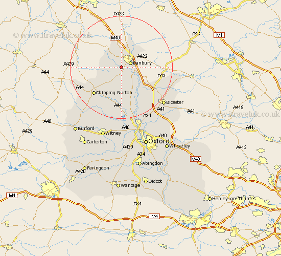
Oxfordshire Map Showing Location of Broughton
Population: 305
District: Cherwell
Easting: 442299 Northing: 237436
Latitude: 52.03 Longitude: -1.38
 = Broughton
District: Cherwell
Easting: 442299 Northing: 237436
Latitude: 52.03 Longitude: -1.38
= Broughton
This Broughton map below is supplied by Google. Use the tools in the top left corner to zoom into street level or zoom out for a road map, you may also need to zoom in to see Broughton on the map. Click and drag the map to move around. If the map fails to load try and refresh your browser or zoom in or out (+ or -).
Update - it seems Google no longer allow people to use their maps for free! This Broughton map sometimes loads and sometimes gives a error. I am working on a solution.
Closest 30 Towns or Cities to Broughton (Population over 500)
Bloxham 3.87km Wroxton 3.89km Banbury 3.89km Barford 5.68km Barford St John 5.68km Barford Saint John 5.68km Barford St. John 5.68km Adderbury 5.87km Deddington 7.19km Cropredy 8.7km Hook Norton 8.82km Wardington 10.09km Duns Tew 11.63km Upper Heyford 13.69km Enstone 13.75km Fritwell 13.83km Steeple Aston 14.17km Chipping Norton 14.86km Ardley 15.93km Barton 16.91km Caversfield 18.54km Chadlington 19.02km Tackley 19.08km Charlbury 19.39km Kirtlington 20.18km Churchill 20.19km Fringford 20.47km Woodstock 20.89km Chesterton 21.59km Bicester 21.8km