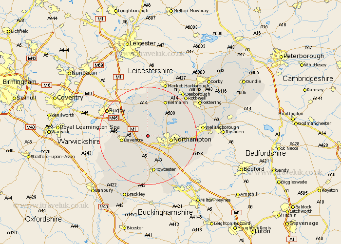
Northamptonshire Map Showing Location of Brington
Population: 482
District: Daventry
Easting: 467096 Northing: 263670
Latitude: 52.27 Longitude: -1.02
 = Brington
District: Daventry
Easting: 467096 Northing: 263670
Latitude: 52.27 Longitude: -1.02
= Brington
This Brington map below is supplied by Google. Use the tools in the top left corner to zoom into street level or zoom out for a road map, you may also need to zoom in to see Brington on the map. Click and drag the map to move around. If the map fails to load try and refresh your browser or zoom in or out (+ or -).
Update - it seems Google no longer allow people to use their maps for free! This Brington map sometimes loads and sometimes gives a error. I am working on a solution.
Closest 30 Towns or Cities to Brington (Population over 500)
East Haddon 3.7km Flore 4.35km Harpole 4.35km Long Buckby 5.03km Weedon Beck 6.52km Weedon 6.52km Kislingbury 6.52km Spratton 7.17km Bugbrooke 7.42km Guilsborough 7.49km West Haddon 8.15km Boughton 8.15km Welton 9.26km Northampton 9.26km Brixworth 9.69km Pitsford 9.8km Daventry 10.38km Crick 10.85km Pattishall 11.12km Moulton 11.49km Milton 11.51km Gayton 11.63km Hardingstone 11.72km Collingtree 12.21km Blisworth 12.49km Kilsby 12.6km Braunston 12.61km Badby 12.64km Wootton 12.98km Yelvertoft 13.03km