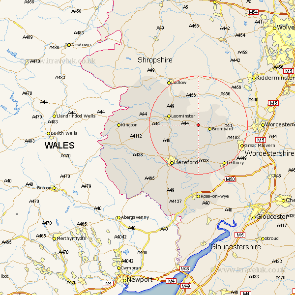
Herefordshire Map Showing Location of Bredenbury
Population: 185
Easting: 361275 Northing: 255948
Latitude: 52.2 Longitude: -2.57
 = Bredenbury
Easting: 361275 Northing: 255948
Latitude: 52.2 Longitude: -2.57
= Bredenbury
This Bredenbury map below is supplied by Google. Use the tools in the top left corner to zoom into street level or zoom out for a road map, you may also need to zoom in to see Bredenbury on the map. Click and drag the map to move around. If the map fails to load try and refresh your browser or zoom in or out (+ or -).
Update - it seems Google no longer allow people to use their maps for free! This Bredenbury map sometimes loads and sometimes gives a error. I am working on a solution.
Closest 30 Towns or Cities to Bredenbury (Population over 500)
Bromyard 4.91km Bodenham 9.71km Whitbourne 11.51km Leominster 11.94km Withington 12.01km Sutton 13.68km Brimfield 14.35km Luston 14.52km Wellington 14.54km Bosbury 15.22km Lugwardine 15.88km Moreton-on-Lugg 15.91km Moreton on Lugg 15.91km Moreton 15.91km Orleton 16.71km Kingsland 16.84km Mordiford 17.29km Burghill 17.6km Colwall 18.03km Croft 18.39km Cradley 18.93km Eardisland 19.4km Credenhill 19.42km Ledbury 19.57km Hereford 19.57km Dilwyn 20.53km Weobley 20.79km Shobdon 21.18km Bullingham 21.18km Fownhope 22.36km