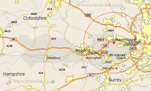
Berkshire Map Showing Location of Bray
Population: 8425
Easting: 490226 Northing: 178750
Latitude: 51.5 Longitude: -0.7
 = Bray
Easting: 490226 Northing: 178750
Latitude: 51.5 Longitude: -0.7
= Bray
This Bray map below is supplied by Google. Use the tools in the top left corner to zoom into street level or zoom out for a road map, you may also need to zoom in to see Bray on the map. Click and drag the map to move around. If the map fails to load try and refresh your browser or zoom in or out (+ or -).
Update - it seems Google no longer allow people to use their maps for free! This Bray map sometimes loads and sometimes gives a error. I am working on a solution.
Closest 30 Towns or Cities to Bray (Population over 500)
Maidenhead 1.86km White Waltham 4.98km Cookham 5.56km Eton 6.92km New Windsor 7.17km Windsor 7.17km Bisham 7.22km Winkfield 7.42km Frogmore House 7.85km Frogmore 7.85km Waltham St. Lawrence 7.85km Waltham Saint Lawrence 7.85km Waltham St Lawrence 7.85km Slough 8.08km Stoke Poges 8.28km Hurley 8.88km Binfield 9.4km Warfield 9.55km Old Windsor 9.81km Horton 9.81km Bracknell 9.89km Datchet 9.95km Twyford 11.03km Ascot 11.36km Wargrave 11.69km Wagrave 11.69km Wraysbury 11.78km Wyrardisbury 11.78km Wokingham 13.08km Remenham 13.22km