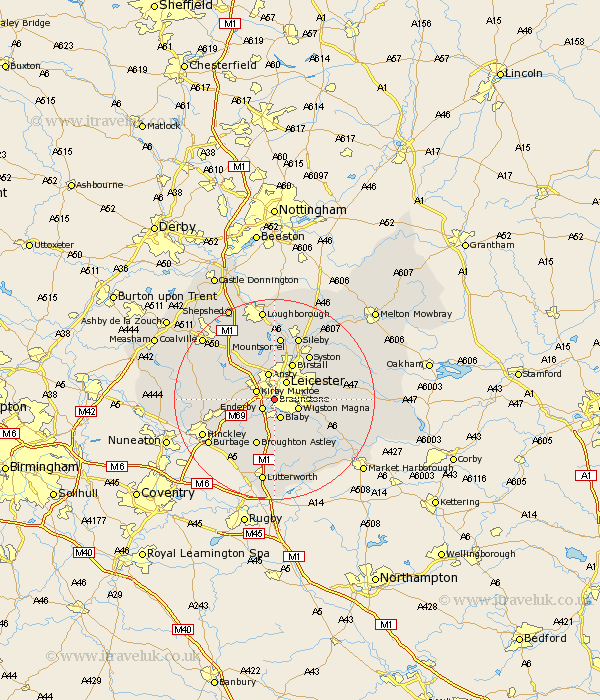
Leicestershire Map Showing Location of Braunstone
Population: 14981
District: Blaby
Easting: 456434 Northing: 300611
Latitude: 52.6 Longitude: -1.17
 = Braunstone
District: Blaby
Easting: 456434 Northing: 300611
Latitude: 52.6 Longitude: -1.17
= Braunstone
This Braunstone map below is supplied by Google. Use the tools in the top left corner to zoom into street level or zoom out for a road map, you may also need to zoom in to see Braunstone on the map. Click and drag the map to move around. If the map fails to load try and refresh your browser or zoom in or out (+ or -).
Update - it seems Google no longer allow people to use their maps for free! This Braunstone map sometimes loads and sometimes gives a error. I am working on a solution.
Closest 30 Towns or Cities to Braunstone (Population over 500)
Enderby 2.92km Kirby Muxloe 3.85km Whetstone 3.87km Blaby 3.87km Leiscester 4.33km Leicester 4.33km Narborough 4.34km Wigston Magna 4.87km Wigston 4.87km Glen Parva 5.01km Glen Parka 5.01km Ansty 5.67km Anstey 5.67km Cosby 5.67km Oadby 5.93km Countesthorpe 6km Croft 7.16km Desford 8.09km Birstall 8.14km Great Glen 9.74km Broughton Astley 9.86km Stoney Stanton 10.03km Elmsthorpe 10.59km Elmesthorpe 10.59km Markfield 10.82km Rothley 11.34km Newbold Verdon 11.41km Syston 11.46km Sapcote 11.47km Sharnford 12.16km