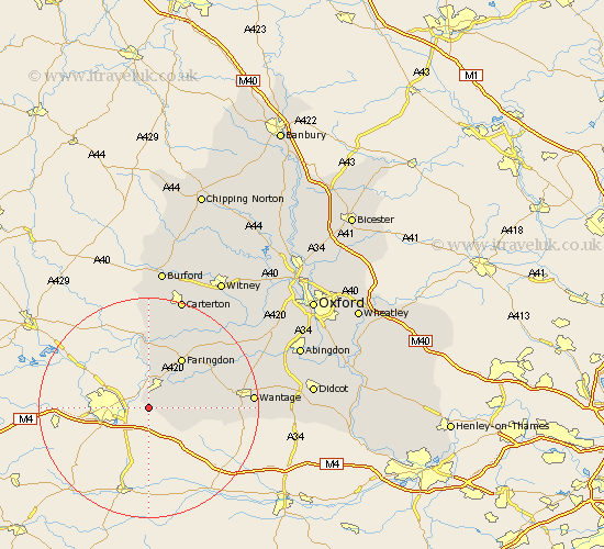
Oxfordshire Map Showing Location of Bourton
Population: 320
District: Vale of White Horse
Easting: 423101 Northing: 185419
Latitude: 51.57 Longitude: -1.67
 = Bourton
District: Vale of White Horse
Easting: 423101 Northing: 185419
Latitude: 51.57 Longitude: -1.67
= Bourton
This Bourton map below is supplied by Google. Use the tools in the top left corner to zoom into street level or zoom out for a road map, you may also need to zoom in to see Bourton on the map. Click and drag the map to move around. If the map fails to load try and refresh your browser or zoom in or out (+ or -).
Update - it seems Google no longer allow people to use their maps for free! This Bourton map sometimes loads and sometimes gives a error. I am working on a solution.
Closest 30 Towns or Cities to Bourton (Population over 500)
Shrivenham 3.88km Watchfield 4.36km Uffington 8.27km Faringdon 10.9km Childrey 12.8km Stanford in the Vale 13.69km Letcombe Regis 14.98km East Challow 15.09km Clanfield 15.9km Buckland 16km Wantage 18.52km Bampton 19.05km Hanney 19.24km East Hanney 19.24km Kingston Bagpuze 20.53km Kingston Bagpuize 20.53km Longworth 20.68km Carterton 21.18km Shilton 22.71km Brize Norton 23.28km Ducklington 23.99km Standlake 24km Steventon 24.81km Marcham 24.81km Milton 25.93km Burford 26.04km Stanton Harcourt 26.11km Drayton 26.39km Harwell 26.74km Witney 27.2km