Essex Map Showing Location of Borley
Population: 99
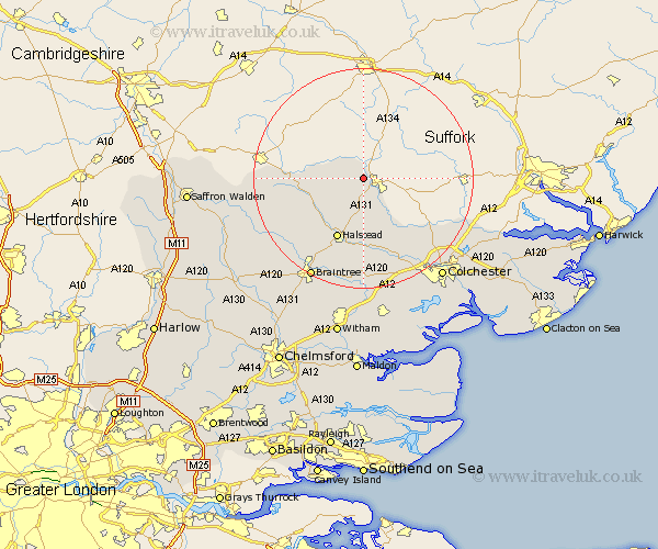
District: Braintree
Easting: 585115 Northing: 242554
Latitude: 52.05 Longitude: 0.7
 = Borley
District: Braintree
Easting: 585115 Northing: 242554
Latitude: 52.05 Longitude: 0.7
= Borley
This Borley map below is supplied by Google. Use the tools in the top left corner to zoom into street level or zoom out for a road map, you may also need to zoom in to see Borley on the map. Click and drag the map to move around. If the map fails to load try and refresh your browser or zoom in or out (+ or -).
Update - it seems Google no longer allow people to use their maps for free! This Borley map sometimes loads and sometimes gives a error. I am working on a solution.
Closest 30 Towns or Cities to Borley (Population over 500)
Bulmer 3.87km Great Yeldham 9.84km Yeldham 9.84km Castle Hedingham 10.09km Ridgewell 11.4km Ridgwell 11.4km Halstead 12.02km Sible Hedingham 12.23km Toppesfield 12.69km Earls Colne 12.98km Wakes Colne 15.22km Gosfield 15.24km Chapel 15.51km Chappel 15.51km Fordham 16.33km Great Tey 17.03km Steeple Bumpstead 17.2km Great Horkesley 17.28km Horkesley 17.28km West Bergholt 17.41km Boxted 18.54km Wethersfield 18.54km Shalford 18.87km Stisted 19.39km Finchingfield 19.46km Great Bardfield 19.71km Coggeshall 20.41km Braintree 20.66km Marks Tey 21.17km Bradwell 21.17km