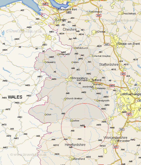
Shropshire Map Showing Location of Boraston
Population: 200
District: South Shropshire
Easting: 361376 Northing: 268927
Latitude: 52.32 Longitude: -2.57
 = Boraston
District: South Shropshire
Easting: 361376 Northing: 268927
Latitude: 52.32 Longitude: -2.57
= Boraston
This Boraston map below is supplied by Google. Use the tools in the top left corner to zoom into street level or zoom out for a road map, you may also need to zoom in to see Boraston on the map. Click and drag the map to move around. If the map fails to load try and refresh your browser or zoom in or out (+ or -).
Update - it seems Google no longer allow people to use their maps for free! This Boraston map sometimes loads and sometimes gives a error. I am working on a solution.
Closest 30 Towns or Cities to Boraston (Population over 500)
Caynham 7.74km Cleobury Mortimer 9.32km Bitterley 10.85km Ludlow 12.61km Kinlet 15.08km Highley 19.35km Diddlebury 19.54km Ditton Priors 20.38km Alveley 20.88km Craven Arms 22.27km Rushbury 24.45km Wistanstow 25.45km Bridgnorth 26.14km Bucknell 26.63km Worfield 29.27km Claverley 30.12km Church Stretton 30.38km Lydbury North 30.9km North Lydbury 30.9km Much Wenlock 31.52km Barrow 32.22km Barrow Bridge 32.22km Clun 33.58km Broseley 33.83km Cressage 35.37km Ironbridge 35.85km Madeley 36.34km Berrington 38.14km Condover 39.08km Dawley 39.5km