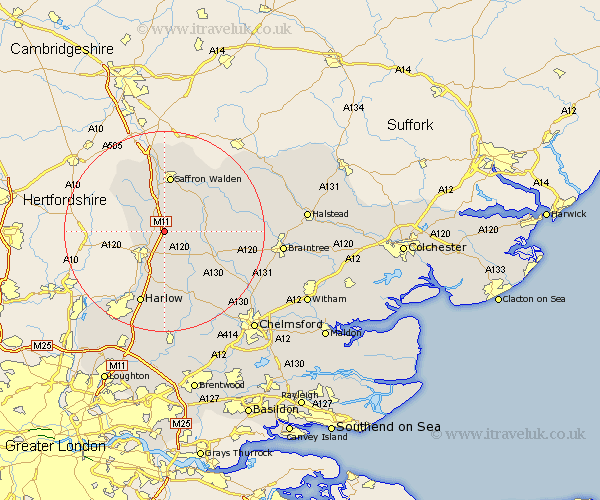
Essex Map Showing Location of Elsenham
Population: 2403
District: Uttlesford
Easting: 553579 Northing: 226646
Latitude: 51.92 Longitude: 0.23
 = Elsenham
District: Uttlesford
Easting: 553579 Northing: 226646
Latitude: 51.92 Longitude: 0.23
= Elsenham
This Elsenham map below is supplied by Google. Use the tools in the top left corner to zoom into street level or zoom out for a road map, you may also need to zoom in to see Elsenham on the map. Click and drag the map to move around. If the map fails to load try and refresh your browser or zoom in or out (+ or -).
Update - it seems Google no longer allow people to use their maps for free! This Elsenham map sometimes loads and sometimes gives a error. I am working on a solution.
Closest 30 Towns or Cities to Elsenham (Population over 500)
Henham 2.17km Stansted 2.95km Stansted Apt 2.95km Stansted Mountfitchet 2.95km Quendon 4.35km Manuden 4.57km Broxted 4.57km Birchanger 5.06km Debden 6.01km Takeley 6.02km Great Easton 7.11km Newport 7.49km Clavering 8.83km Hatfield Broad Oak 9.34km Thaxted 9.86km Great Dunmow 9.87km Dunmow 9.87km Hallingbury 9.89km Great Hallingbury 9.89km Wimbeis 10.88km Wenbech 10.88km Wymbyshe 10.88km Wimbish 10.88km Winbeche 10.88km Gwimbach 10.88km Winebisc 10.88km Saffron Walden 11.18km Radwinter 11.52km Littlebury 13.02km Hatfield Heath 13.03km